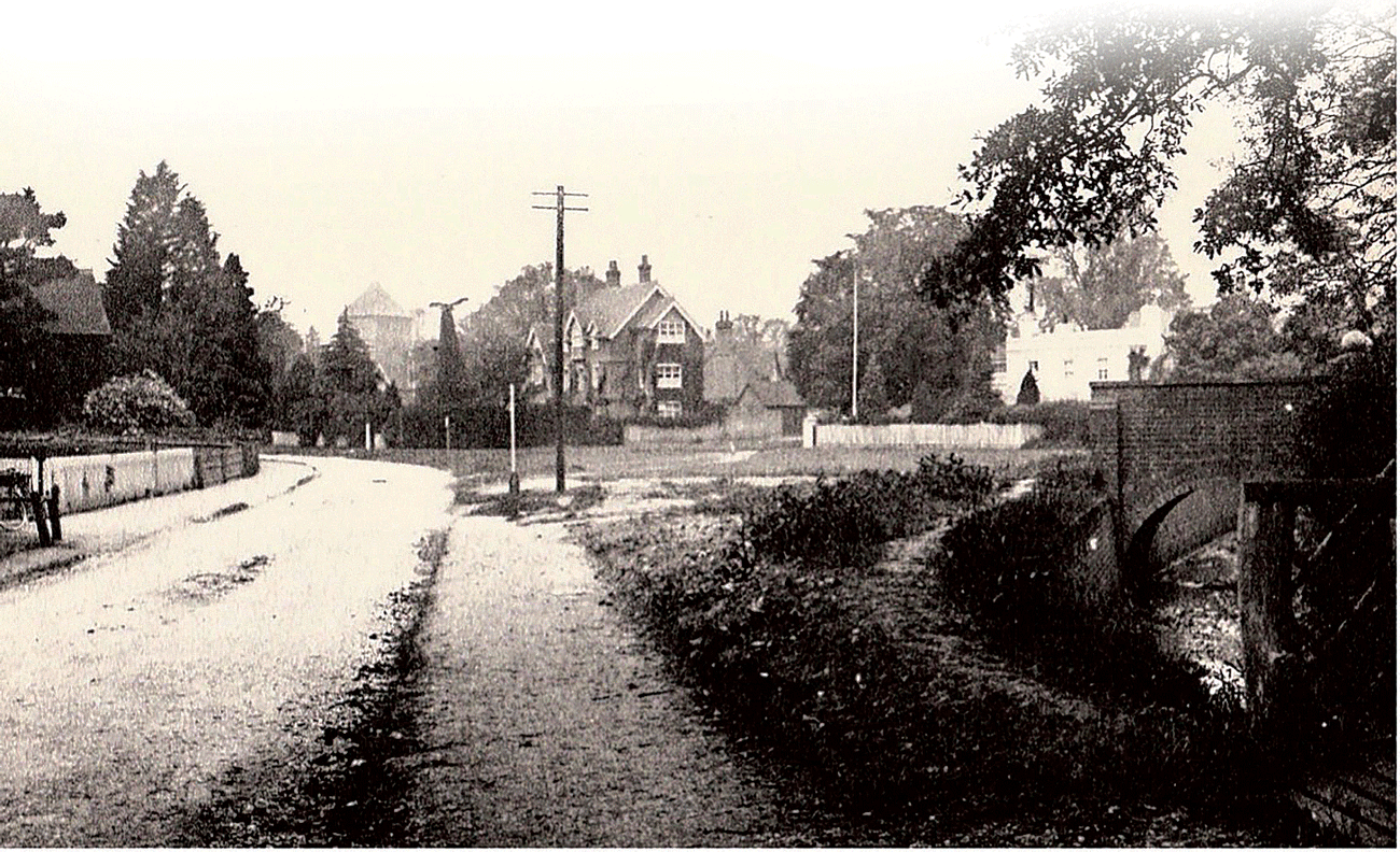
By Joy Horn (Main Photo – From Horsham Road towards the church. The bridge on the right leads to the Police House (courtesy of Vera Wilkinson))
Streams or dry ditches of the Cranleigh Waters can be seen throughout the Village. What follows is just one possible discovery walk. It is about 1¼ miles in length, with resting places, starting at the junction of New Park Road and Ewhurst Road. This is one of the bridges that Stephen Rowland constructed for access to the new estate he developed from the 1890s. The stream has reached this point by flowing along the side of Ewhurst Road from the Showground.
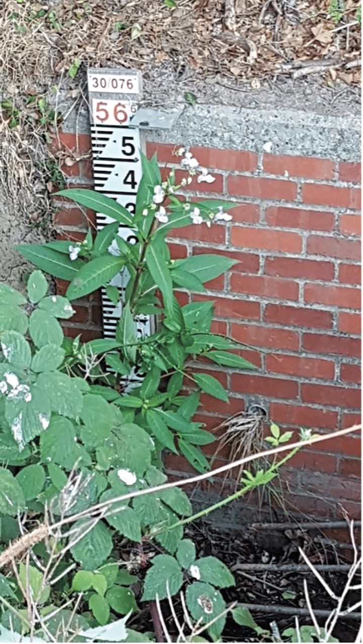
The Cranleigh Waters are created by springs and rains on the Surrey Hills. On several occasions rain on the hills has caused the streams to overflow and to flood the centre of Cranleigh, notably in 1904 and 1968. After this, the stream was eventually taken underground at this point.
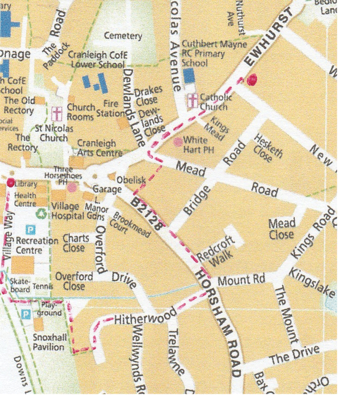
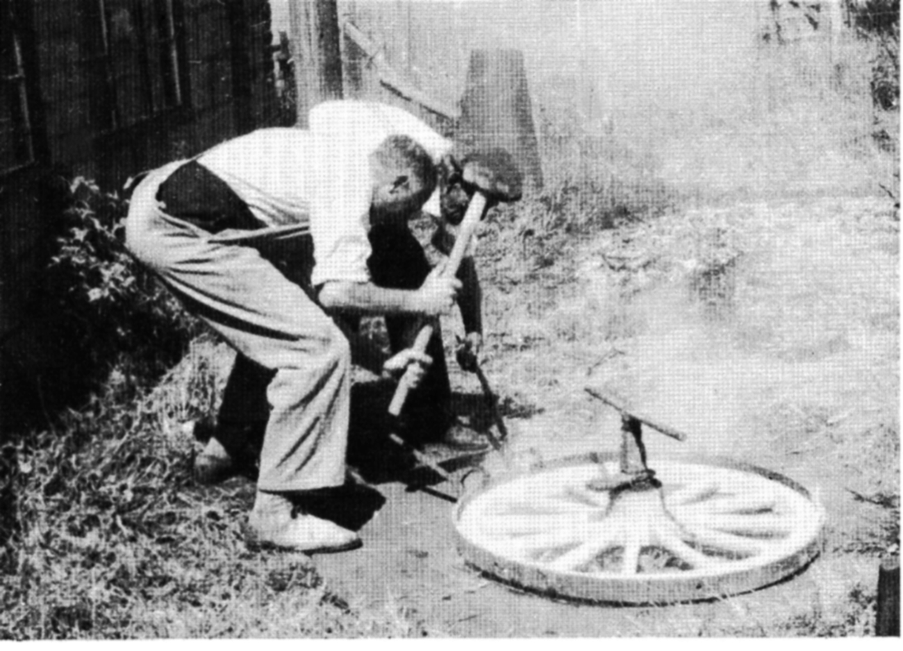
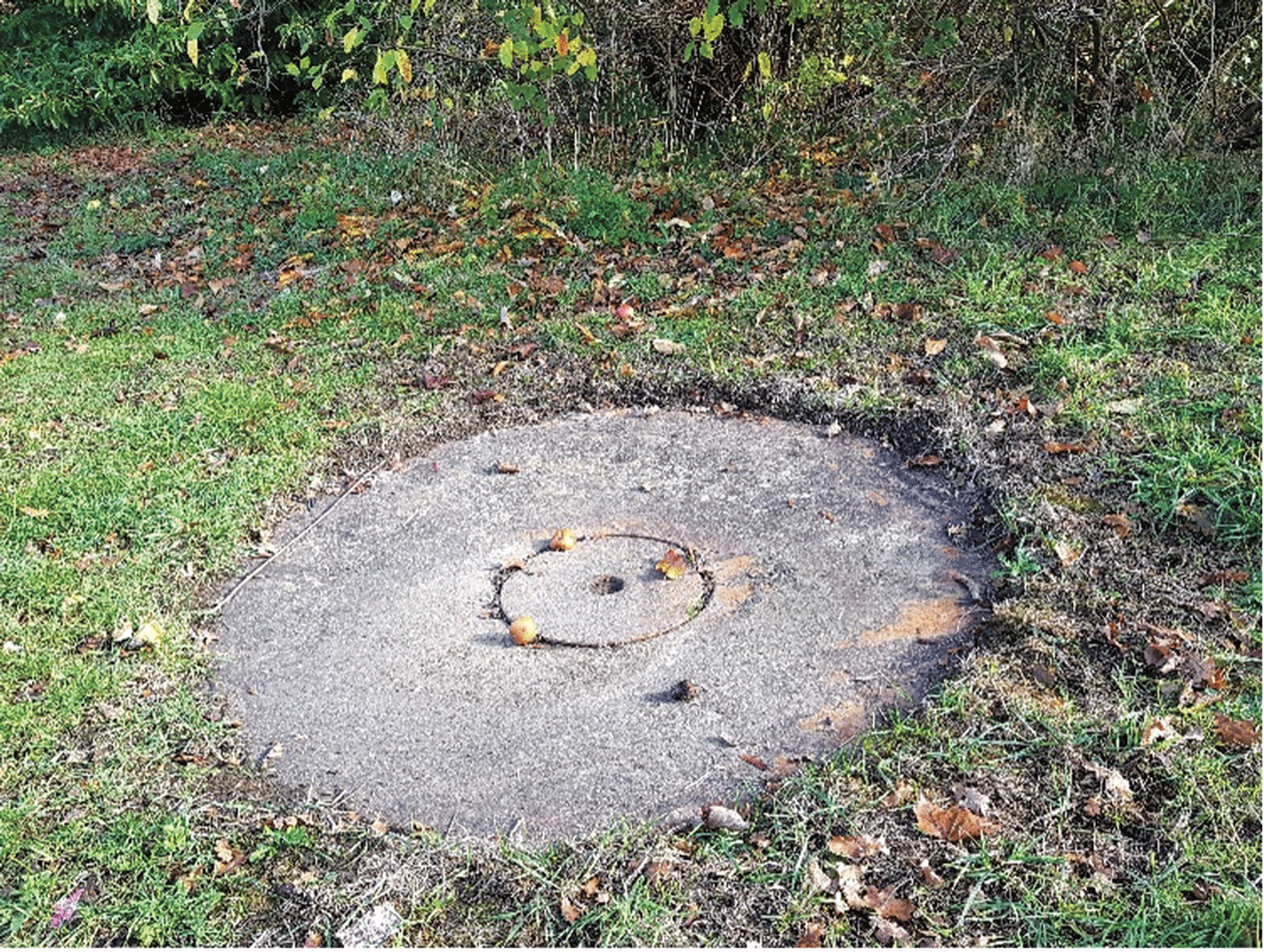
As you walk towards the Village, you pass Sussex House and Cranleigh Memorials, formerly the home and shop of Bert Lade the butcher, who described how six inches of flood water burst into his house from both the front and back doors, during the floods of 1968! The stream today passes safely in its culvert behind the ‘White Hart’. Turn left at Mead Road and rediscover the stream after the cluster of old farm buildings, where it goes under the road and surfaces on the right in what was once called Luck’s Green. Here the stream was used by the blacksmith working in the forge. It is now disused, on the right, but you can look in through the window to see some of his equipment. Opposite, on the left, look out for the ‘tyring plate’ for fixing metal bands to wagon wheels. A wooden wheel was fixed flat to the centre of the plate and a red-hot metal ring was carried with tongs from the forge and placed around it. Water from the stream was poured on to the wheel, causing much steam and hissing, to make the metal contract firmly around the wheel.
Follow the stream as it flows to the side of Horsham Road, passing the former Evangelical Free church building (closed about 2000) and the former Police House (closed about 2010). Go along Horsham Road, noticing another of Stephen Rowland’s bridges accessing Bridge Road, and giving its name. Just before Mount Road, the stream crosses under the road into Hitherwood. There used to be a ‘clapper bridge’ here, that is a basic bridge for pedestrians, probably of planks or logs supported on piles of stone, while vehicles went through the shallow water. This stretch of Horsham Road was called ‘Clapper Lane’ on the 1895 Ordnance Survey map.

Go along Hitherwood to Overford Drive, then make a short detour along it to see where a bridge goes over the Cranleigh Waters. This was where people and vehicles splashed through a ford, before the bridge took the road ‘over the ford’.
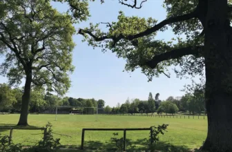
Return to Hitherwood and follow the road as it bears left. Take the footpath on the right between numbers 29 and 31 Hitherwood into Snoxhall recreation field. Turn right, and rejoin the stream at the Centenary Garden, where the iron poppy heads (one for each local man killed 1914-18) were made in 2018 at the forge we passed earlier.
The stream now flows past the rear of the swimming pool. This was opened in 1970, and saved young people from swimming in local ponds and lakes, with occasional fatal results.
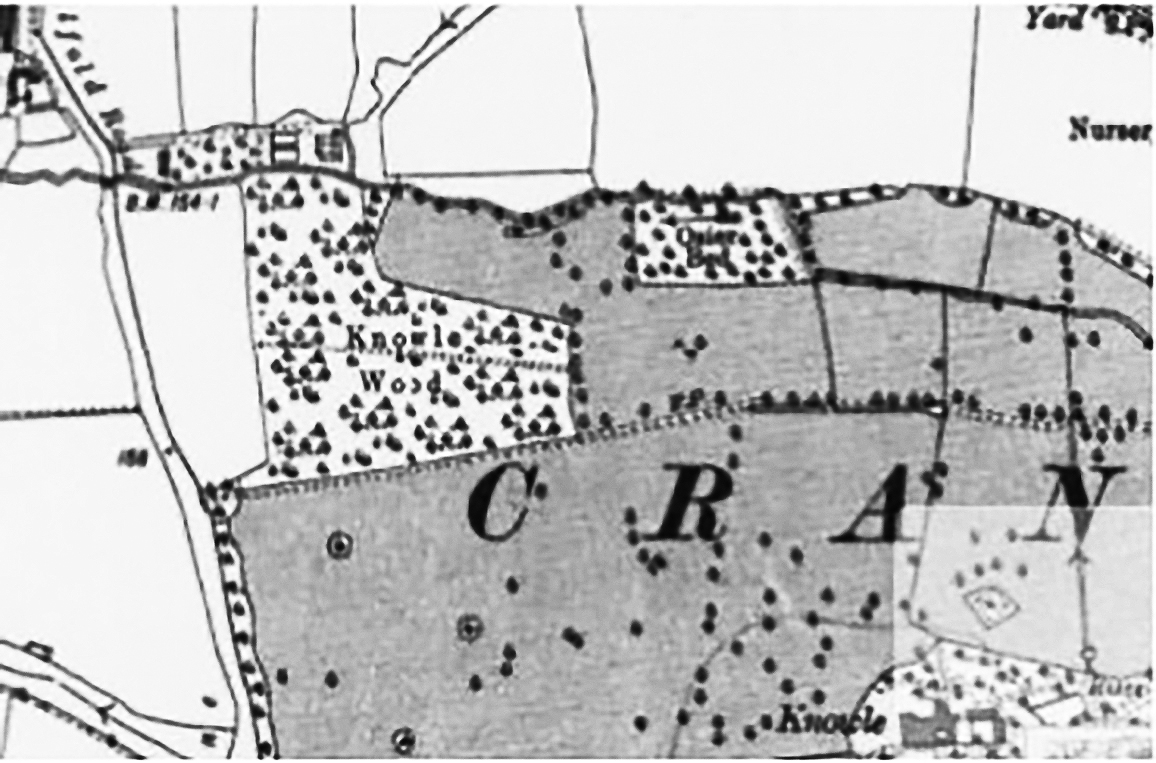
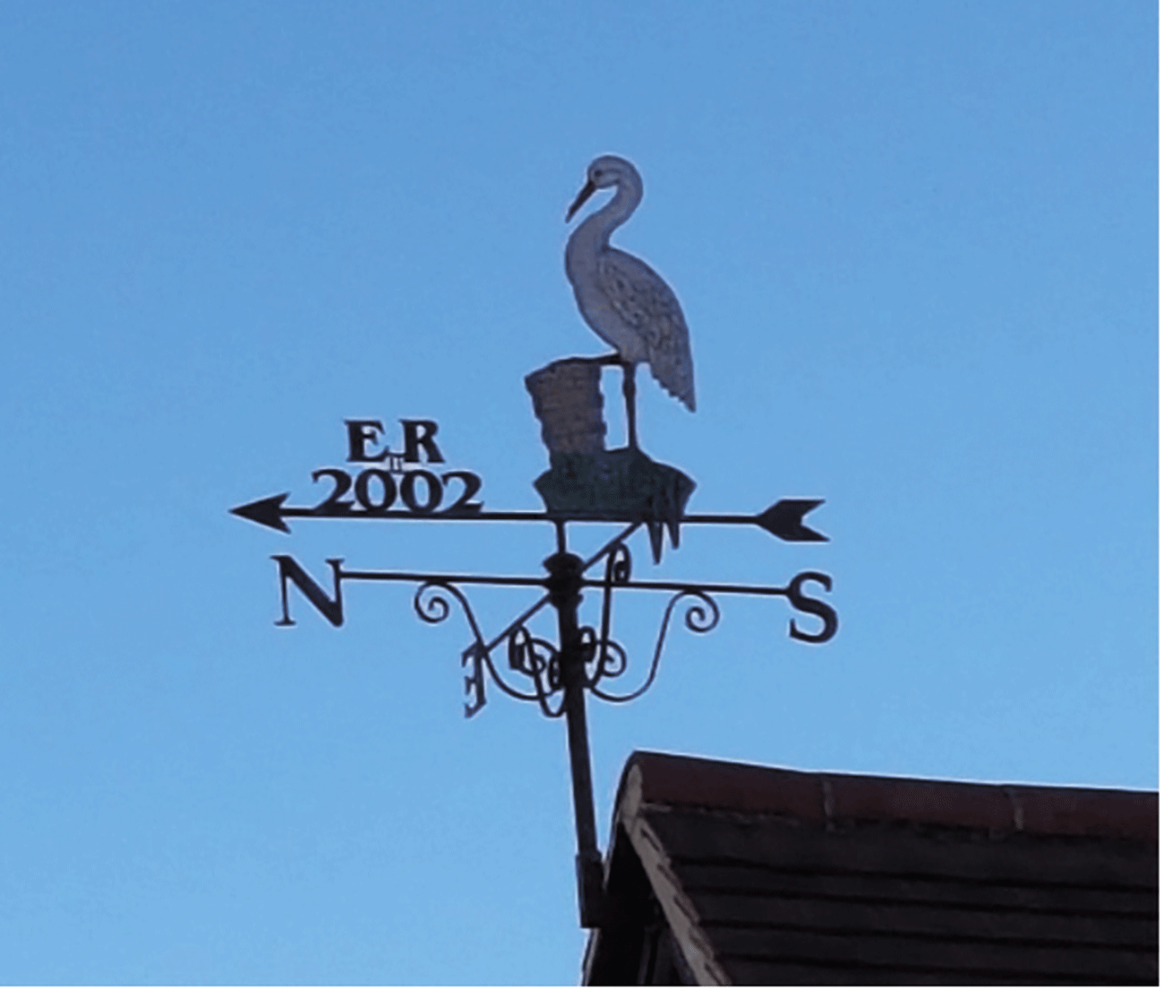
Turn right here and go along Village Way to the High Street. Notice on the weathervane of the Village Hall porch the crane with a wicker basket. Basket-making was once a local cottage industry, using osiers (a type of willow), which grew in a managed osier bed by the Cranleigh Waters beyond where we left it, in the new Knowle Park.
In the Village centre, see whether you can spot other cranes with baskets, on bench ends, waste bins and on top of the Fountain.
The Cranleigh History Society meets on the second Thursday of each month at 8.00pm in the Band Room. The next meeting is on Thursday April 13th, when John Ashworth will speak on ‘Leith Hill Place’. Visitors are welcome.