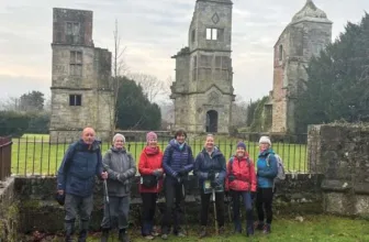
Photo by Users on AllTrails
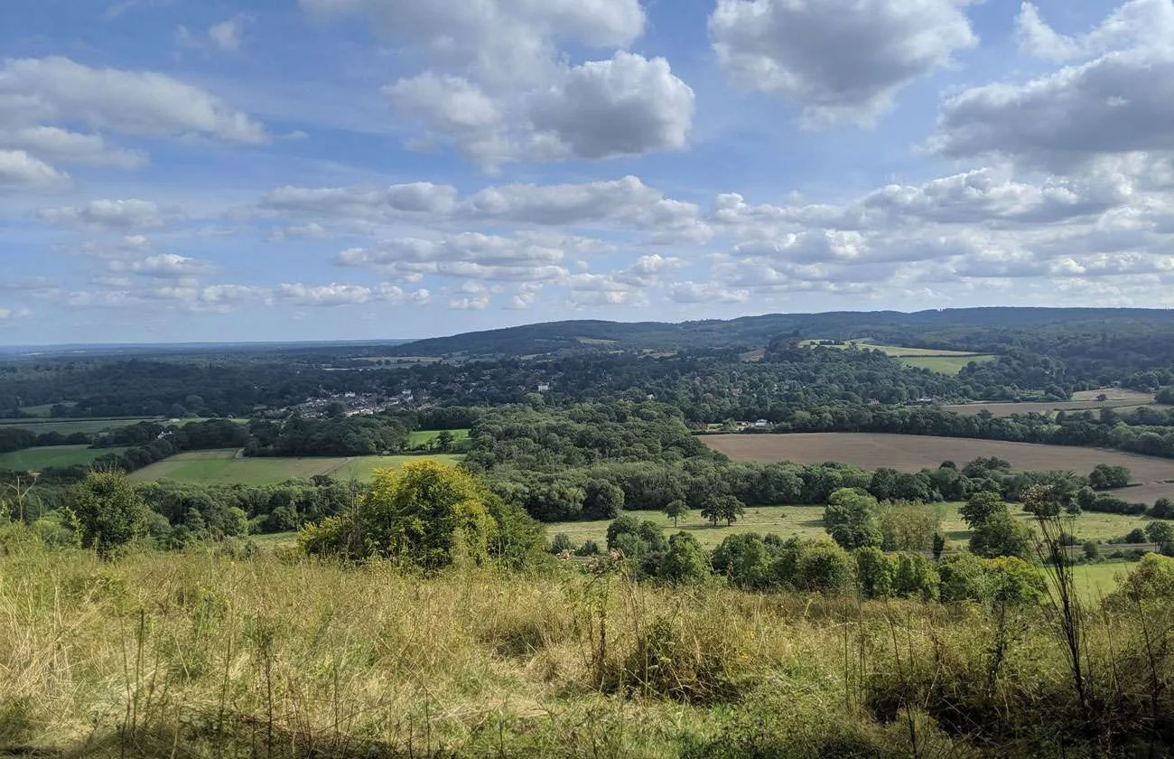
Ranmore Circular is a loop trail located near Holmwood, Surrey, England that features a great forest setting and is rated as moderate. The trail is primarily used for hiking, walking, and running and is accessible year-round.
Distance: 9 km
Time: Est. 3 hrs 2 mins
Route Type: Loop
Elevation Gain: 348 m
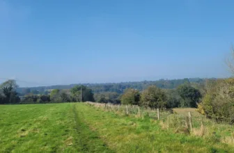
Walk Information: A circular walk from Boxhill and Westhumble Station in the village of Westhumble, passing through part of the Polesden Lacey Estate, Ranmore Common and Denbies Vineyard. The route follows part of the North Downs Way National Trail.
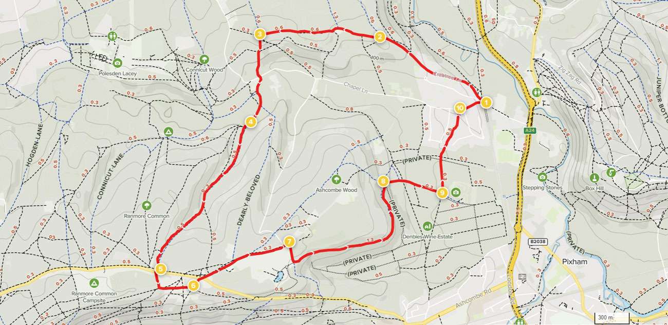
Waypoints
1. Start to Crabtree Lane Car Park
The walk starts from Boxhill and Westhumble rail station. Leave the station platforms and walk through the small car park to reach a T-junction with Westhumble Street. Turn left and then join the pavement to cross the railway bridge. Immediately afterwards, fork right into Crabtree Lane. Follow the quiet lane ahead, taking care of any occasional traffic. In the fields to the right you can see the River Mole meandering through Norbury Park and the Mole Gap. After climbing steadily for 1km, you will pass the Norbury Park Crabtree Lane car park on the right.
2. Crabtree Lane Car Park to Woodland Edge Crossroads
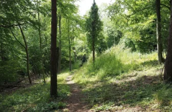
(Note: if you are starting the walk here, exit the car park back onto the lane and turn right). Follow the lane steadily uphill for 400m. On the top of the hills to the left you can see the St Barnabus church spire at Ranmore which we will be passing later on this walk. Keep straight ahead at the junction, passing Crabtree Cottages on the left. Immediately afterwards, ignore the footpath signed to the left. Simply keep ahead on the footpath which leads you past fields and through woodland for 670m. At the far edge of the woodland, you will come to a signed crossroads of paths.
3. Woodland Edge Crossroads to Gate into Woodland
Turn left on the bridleway which leads you downhill through the woodland. At the staggered crossroads keep straight ahead, continuing downhill. At the bottom of the woodland you will come to a single gate ahead. Pass through this to enter a pasture and walk at 11 o’clock for just a short distance to reach a gate out to the road. Turn left and then immediately right to join the track signed for Bagden Farm and a youth hostel. The track swings right to enter the Polesden Lacey Estate. Continue past the farmhouse and barns on the right, then stay on the main track which climbs for a further 120m. You will come to a pair of gates ahead. Pass through the smaller of these and keep in the same direction across the pasture, passing to the right of the large oak tree in the centre of the field. At the far side, a gate leads you back into woodland.
4. Gate into Woodland to Ranmore Road
Keep ahead along the track for just 50m, then fork left. Stay on this main wide bridleway track which climbs steadily through the woodland. Some way along, keep left to merge with another bridleway coming in from the right. 100m later you will reach a fork, take the right-hand branch. Towards the top of the slope you will reach another fork. Keep right and follow the track which swings left, passing the cottages on the right. You will emerge out to a T-junction with Ranmore Road.
5. Ranmore Road to Cottage Junction
Cross over the road with care and turn right along the grass verge for just 40m. Turn left onto the signed public footpath, an unmade track between hedgerows. Pass by an old gate and then turn sharp left to join the North Downs Way, a National Trail. After just a few paces, go through the gate ahead to enter Steers Field. Take the right-hand of the two grass paths ahead, taking time to enjoy the views from this hillside, Denbies Hillside. After passing some cottages on the left you will come to a signed junction of paths. Turn left, staying on the North Downs Way.
6. Cottage Junction to Denbies Lodge
Go through the kissing gate then walk diagonally right across the verge. Cross Ranmore Road with care and follow the side road opposite. Follow the quiet road, taking care of any traffic, and it will lead you past the large parish church of St Barnabus on the right. Keep straight ahead along the lane for a further 0.5km, ignoring any paths signed off to the left. Where the main road swings left, keep straight ahead past the white vehicle barrier to join a concrete track with Denbies Lodge on the right.
7. Denbies Lodge to Denbies Crossroads
Keep ahead for just a few paces and then take the first turning on the right, a stone track between fields. Turn left at the next junction, still following the North Downs Way. Pass through the gate ahead to enter Denbies Wine Estate. You will now have glorious views ahead and across the vineyard slopes. Continue along the track, pass through a second gate and follow the track as it swings left. There are views ahead across the Mole Gap to Box Hill. Follow the track meandering down through woodland to reach a signed crossroads of tracks.
8. Denbies Crossroads to Bradley Farm
Turn right, leaving the North Downs Way to join the public bridleway. Follow the track which heads downhill. Bear right to join the concrete track heading for the complex of farm estate buildings. A few paces before you reach the buildings ahead, you will see a signed crossroads of paths. If you wish to visit the Denbies Wine Estate visitor centre and cafe, keep ahead past the house and farm buildings, then turn left into the centre’s car park. Otherwise, for the main route, turn sharp left at this crossroads to join the wide grass track which runs between the vineyards.
9. Bradley Farm to Chapel Lane
Follow the wide grass track and, at the end of the vineyard, pass through the gate. Cross over the stone track and go ahead through a gate into a field. Cross the field at 1 o’clock to reach a kissing gate on the far side. Go through this gate and join the narrow footpath between gardens. You will eventually emerge out to a quiet residential road, Adlers Lane. Cross over and join the narrow footpath which continues ahead. This path leads you steadily uphill and out to a T-junction with the road, Chapel Lane.
10. Chapel Lane to End
Turn right along the road then fork right between the white fencing to join the raised pavement running along the right-hand side of the road. Further down, join the pavement immediately alongside the road and you will pass the end of Crabtree Lane on the left. (Note: if you are parked in Crabtree Lane car park, turn left here and follow the lane for 1km to reach the car park on the right). Otherwise, keep straight ahead on the pavement which swings right and leads you over the railway bridge. You will come to Boxhill and Westhumble Station on the right where the walk began.
See more info on the walk at: www.alltrails.com