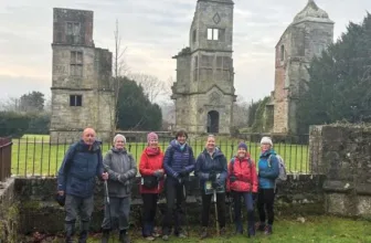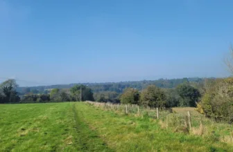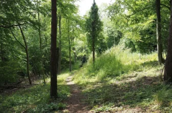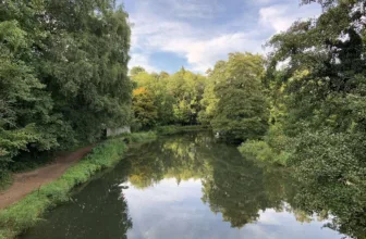
Photos by Users on AllTrails
Silent Pool, Albury Downs, and Saint Martha’s Hill Circular is a trail located near Shere, Surrey, England that features a great forest setting and is rated as moderate. The trail is primarily used for hiking, walking, and running and is accessible year-round.
Distance: 9.3 km
Time: Est. 2 hrs 19 mins
Route Type: Loop
Elevation Gain: 321m
Walk Information:
A circular walk in the Surrey Hills AONB, visiting a number of popular attractions including Silent Pool, a stretch of the North Downs Way, Newlands Corner and St Martha’s Hill and truly offers outstanding natural beauty.
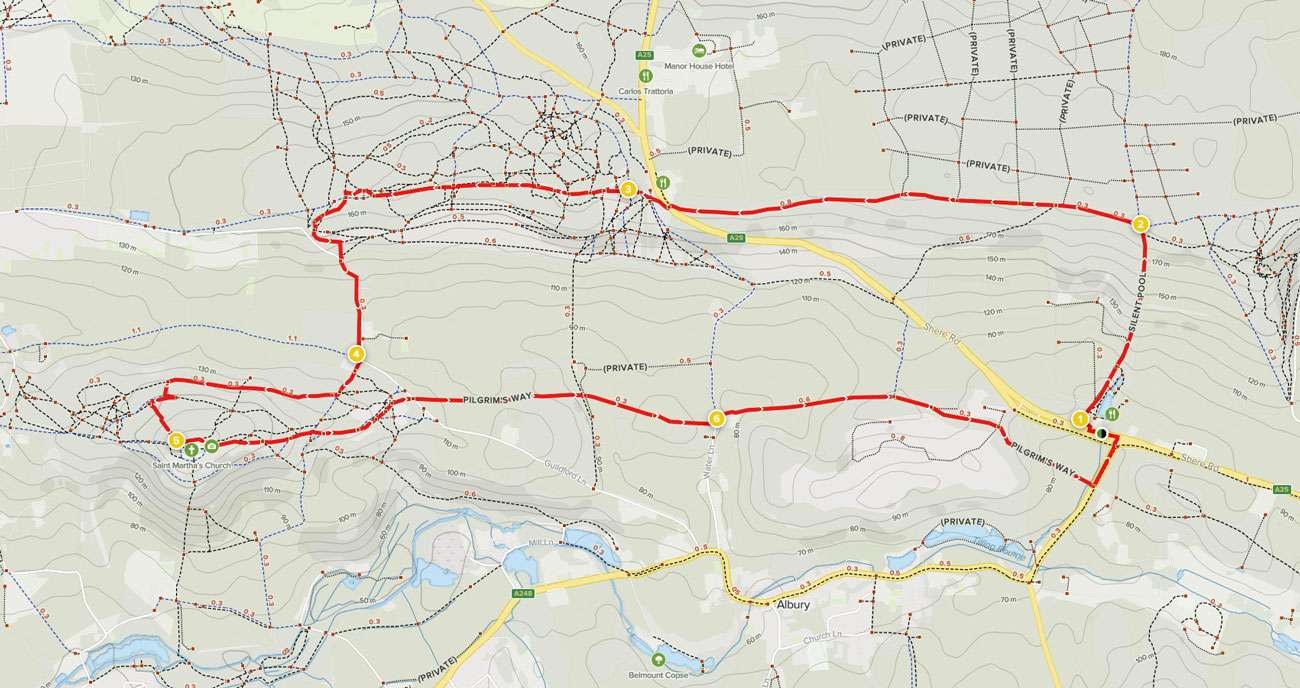
Waypoints
1. Start to North Downs Way
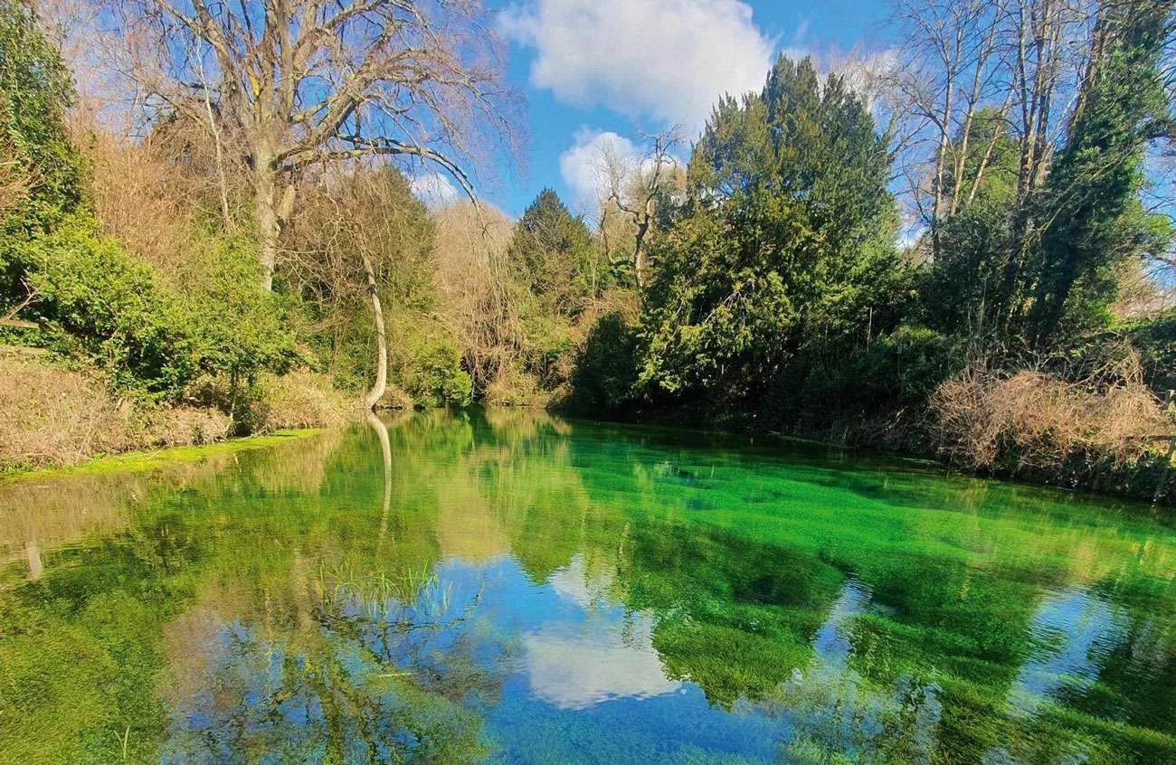
From the Silent Pool car park, take the path which starts between two noticeboards, about halfway along the car park’s length. Follow this path heading away from the road and then swinging right to reach a junction with a vehicle track. Go straight ahead to reach the viewing platform at Sherbourne Pond, the newer of the two pools here. When you have finished on the viewing platform, come back to the stone path and turn right along this, following the line of a fence on your right. NOTE: If this path is closed for maintenance, there is a footpath running parallel 10 metres to your left. Stay with the fence on your right as the path leads you past Sherbourne Pond. At a junction in the path you will come to Silent Pool ahead. Turn left up the flight of wooden steps to reach a T-junction with the higher parallel footpath. Turn right along this, with the vineyard running on your left. Stay with this path as it begins the steep climb up the North Downs. Underfoot and in the right-hand banks you will see the white chalk bedrock of the downs. Stay with this path all the way to the top of the hill where it meets a crossroads with the North Downs Way, marked with a fingerpost.
2. North Downs Way to Newlands Corner
Turn left to join the North Downs Way heading west. You will pass a waymarker post with a purple arrow and this Purple Ox Trail route is the one you will be following throughout. Simply stay ahead on the North Downs Way, following it for some distance until you emerge alongside a vehicle barrier to reach a junction with the A25. Cross over with care. Turn right along the stone path and follow it up into the car park at Newlands Corner. Bear left, to walk along the length of the car park, passing the toilets and visitor centre across to the right.
3. Newlands Corner to Keepers Cottage
Continue through the Newlands Corner car park, heading away from the road, all the way to its end. At the far end, pass alongside the vehicle barrier and continue directly ahead on the obvious path running along an avenue within the woodland. Pass alongside the next vehicle barrier and continue on the woodland track. Ignore any small paths into the clearings. Further along, keep a look out for a fingerpost on the right which marks a permissive horse ride on your right. DO NOT take this, instead keep ahead for 10 metres to reach a small waymarker post on your left. Turn left and follow this path into the trees. The path swings right leading you under several large yew trees. Immediately after these you will pick up the next waymarker. Follow the arrow which directs you onto the path swinging steadily left, heading downhill, and you will emerge into a parking area. Cross over and take the continuing purple path directly ahead. The stone path swings left. At the next waymarker post turn sharp right onto a stone path heading downhill through the trees. Keep left at the fork. Pass through the staggered barrier to reach a junction. Cross over and take the steps directly ahead. At the top, the path swings left to run parallel with the road. Stay with this roadside path as it leads you steadily downhill until you reach a T-junction with a half-timbered black and white cottage directly ahead, Keepers Cottage.
4. Keepers Cottage to St Martha’s Church
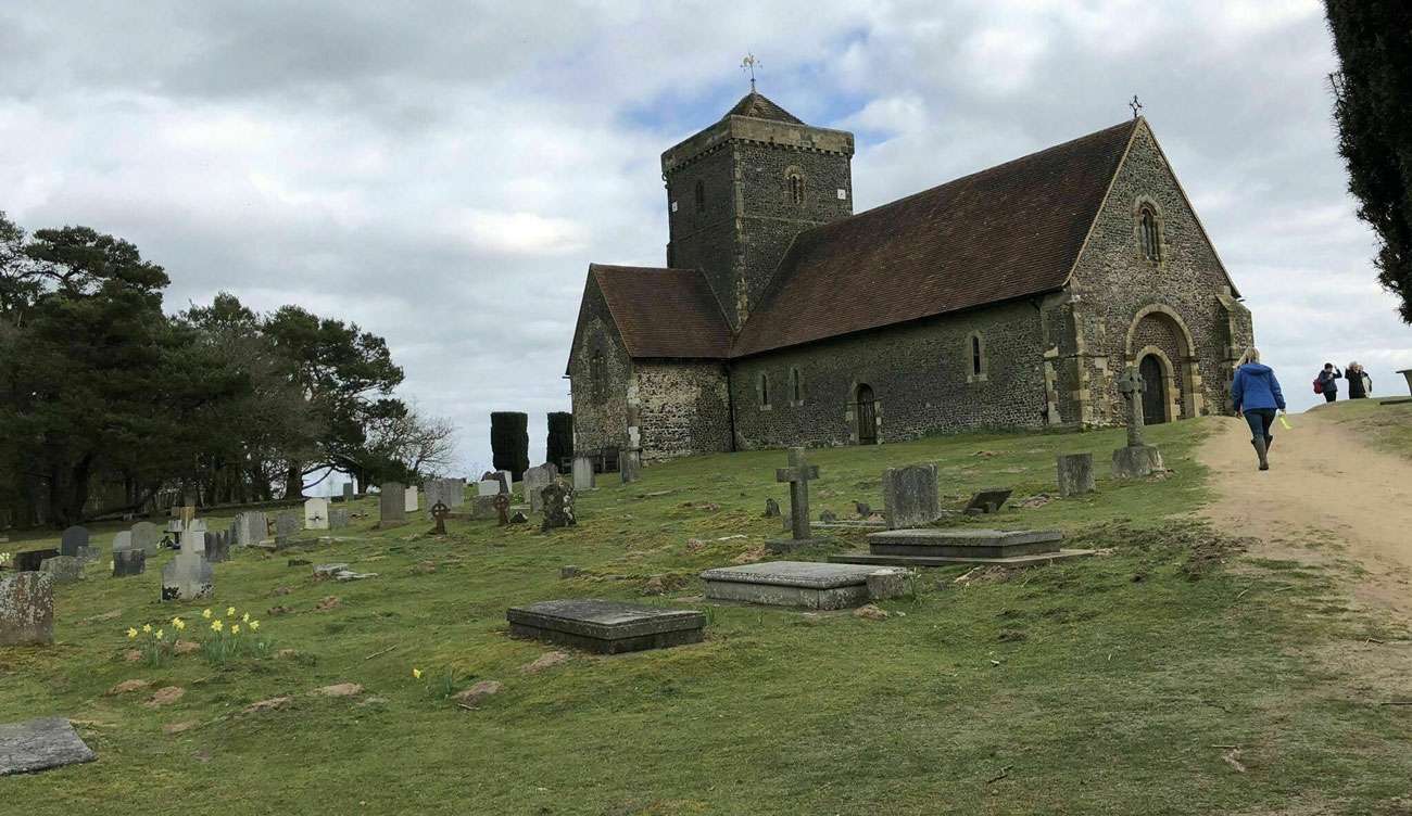
Turn left and then immediately right onto the stone track signed as the North Downs Way, passing the cottage on your right. Soon after the fence ends on your right, you will pick up the next purple waymarker. Stay with this path which leads you to a major junction, marked with a couple of waymarker posts. Turn right here to join the permissive horse ride, also marked with the purple arrow. Follow the main obvious path which winds and undulates along the northern edge of St Martha’s Hill, passing between several tall coniferous trees. As you pick up the next waymarker post, stay with the purple trail which bears left heading uphill to reach a T-junction. Turn right and you will pass a stone boundary marker dating from 1933. 20 metres later, turn left onto a sandy path leading you uphill once again. At the top of the hill you will come to St Martha’s Church directly ahead.
5. St Martha’s Church to Water Lane
Turn left immediately before the church, joining the North Downs Way once again and passing the church immediately on your right. Beyond the churchyard, keep ahead on the most obvious path which bears right leading you to the southern edge of the hilltop. Turn left to join the wide sandy path with the fence and views running on your right. Just as the fence ends you will come to a fork, keep right and follow this path fairly steeply downhill. Stay with the main path heading gently downhill, ignoring all the side paths. Towards the bottom you will pass a brick pillbox on your left and, soon afterwards, the path leads you directly into the St Martha’s Hill car park. Leave the car park through the vehicle entrance. Turn right along Guildford Lane for 50 metres and then turn left to join the signed public bridleway. Stay with the left-hand fence line and, further along, the path leads you past a woodland on your right. Beyond the woodland you will come to a crossroads with a grass track. Go straight ahead through the gap in the hedge and walk diagonally right across the field. As your path reaches the right-hand fence line, fork right between the old gate posts to join a narrower path into the trees. Stay with the path as it leads you steadily downhill and then makes a steeper descent to reach a junction with a sunken lane, Water Lane.
6. Water Lane to End
Turn left and then immediately right to join the stone access track, a public bridleway. After passing a house on the right, keep directly ahead alongside a gate and follow the path between fields. Simply follow this path climbing steadily and eventually you will reach a property on your right, Timbercroft. Continue ahead, passing the house on the right and a smallholding paddock on the left. Beyond this paddock, follow the vehicle track ahead and at the fork bear right to join a smaller path leading you through the trees. Further along you will come to a junction with the concrete access track for a waste facility site, so take care of any lorries. Cross over and continue ahead on the woodland path. This stretch of path will lead you to a stile. Cross the stile into the field and walk straight ahead following the left-hand fence line. At the far side cross the stile and then go through the kissing gate to reach the A248. Cross over with care and turn left along the pavement. You will come to the junction with the A25 dual carriageway. Use the designated crossing point to cross the dual carriageway, taking particular care as the traffic is quite fast moving. At the far side turn left along the pavement and you will come to the Silent Pool car park on your right where the walk began.
See more info on the walk at: www.alltrails.com