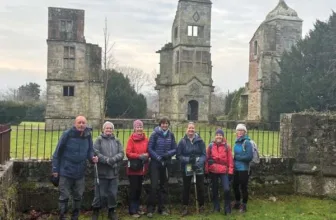
Photos by Users on AllTrails
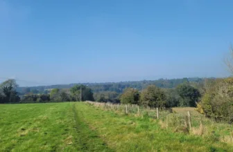
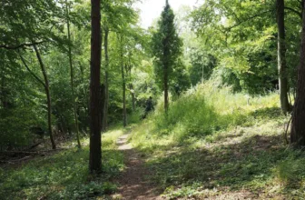
A circular walk from the village of Tilford passing close to The Sands village and the historic ruins of Waverley Abbey. From the top of Crooksbury Hill there are good views to the South Downs on a clear day. This walk is published through a collaboration with the Surrey County Council. The walk involves several steady gradients plus one steeper climb to the top of Crooksbury Hill. The paths and tracks through the commons and woodlands are all unmade and can get quite muddy so good boots are recommended. There are some sections of road walking so take care of traffic on these stretches. You will need to negotiate a long flight of steps but there are no kissing gates or stiles on route.
Distance: 10.1 km
Time: Est. 2 hrs 30 mins
Route Type: Loop
Elevation Gain: 311 m
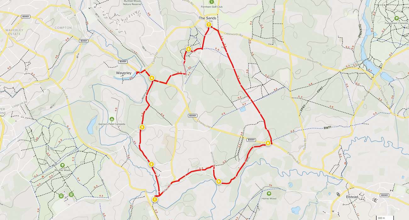
Waypoints
1. Start to Squires Hill Lane
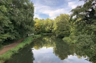
From the village green, walk over to the north-east corner where you will find East Tilford Bridge, a bridge over the River Wey. Cross East Tilford Bridge using the left-hand pavement, heading towards the village shop. A few paces later, just before you reach the shop/post office, turn left onto the signed bridleway. Follow this path for approximately 540m, all the way to the top where you will reach a T-junction with Squires Hill Lane.
2. Squires Hill Lane to Sheephatch Lane
Turn left along the lane and pass Tilhill House on the right. Keep straight ahead on the sandy track which leads you into the woods. Soon you will come to a fork at a waymarker post. Take the right-hand branch here, signed with a red arrow, a public byway. Follow this sandy track heading uphill which leads you past the property Ebernoe on the left and then Sheephatch Farm on the right. At the staggered T-junction, bear right and follow the drive to reach the road, Sheephatch Lane.
3. Sheephatch Lane to Waverley Lane
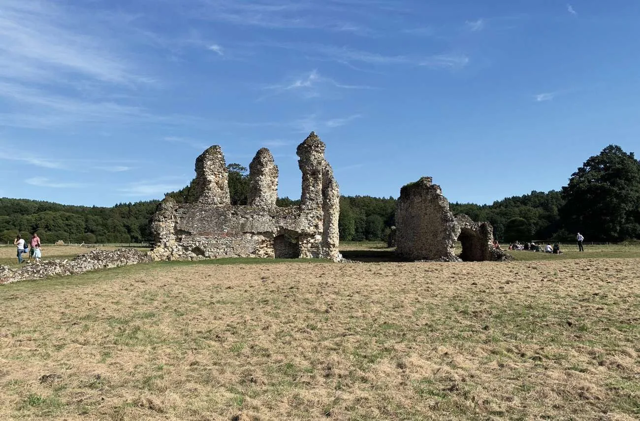
Cross over the road with care and take the track opposite (signed as a public byway). Follow this track between conifer plantations for about 400m. At the bottom of the slope you will come to a T-junction. Turn left and follow the track which later swings right. The ruins of Waverley Abbey can be seen through the trees to your left. Continue ahead to reach a T-junction with the road, Waverley Lane.
4. Waverley Lane to Crooksbury Hill
Turn right heading uphill along the road edge. You will pass the entrance to Keepers Cottage Stud Farm on the left. Right afterwards, turn left onto the track signed as a bridleway to Yew Tree Cottage. Follow the track steadily uphill, passing Yew Tree Cottage on the left and continuing into woodland. At the top of the slope you will pass the Waverley Cottages on the left and emerge out to a T-junction with Crooksbury Road. Cross over the road with care and take the signed bridleway opposite, which swings sharp left to run parallel with the road on the left. Keep left at the first fork and then left again at the second fork and the path will lead you into the back of Crooksbury Hill car park. Turn right within the car park, passing between a pair of benches, to join the waymarked footpath. The path leads you up the hill via a series of wooden steps. At the top you will reach the summit of Crooksbury Hill.
5. Crooksbury Hill to The Sands
Stand with your back to the view and join the path directly ahead. After just a few metres, bear right on the narrow path to begin your descent. Further down, at the fork, bear right again. Continue through the barrier, straight over the crossroads and past a vehicle barrier towards the road. Don’t continue to the road, turn left immediately after the barrier to join a footpath which runs parallel with the road on the right. At the fork, turn right out to the road and then turn left along the grass verge passing between houses. Follow the road down to the crossroads.
6. The Sands to Farnham Road
Turn right past the Barley Mow pub on the right and follow this road (taking care of traffic) for 230m, passing the village boundary signs. Turn right onto the long straight track, Long Hill. The lane climbs steadily between properties and then leads you down past a vehicle gate to enter Crooksbury Common. Keep ahead on the sandy track, a public bridleway, across Crooksbury Common for 720m. At the common edge, continue ahead on the track past the houses. Eventually, the track leads you out to a T-junction with the road, Farnham Road.
7. Farnham Road to Whitmead Lane
Cross over the road with care and turn right down the entrance lane leading to The Donkey pub. Continue on the track which leads you past the pub on the left and then begins to climb. You will pass Riversleigh Farm on the left. Just beyond this you will come to a staggered crossroads. Turn left (passing Ravenswing on the left) and stay on this track for 1.1km to emerge out to a junction with the road, Whitmead Lane.
8. Whitmead Lane to End
Turn right and follow the road uphill. After 300m, just after passing a house on the left (and by a post box on the right), turn left to join a narrow fenced path between gardens. Stay on this path, following the fence line on the right, and it will lead you between horse paddocks and then along a ridge. At the end of the path, keep ahead to merge with the residential access drive. Keep ahead along this drive to reach a junction. Turn left and then immediately right (taking care of traffic) and this lane will lead you out to a T-junction with the main road. Taking extreme care at this junction, cross the main road and then turn left along the pavement. The pavement will lead you past the village stores and back over the river bridge to reach the village green in Tilford where the walk began.
See more info on the walk at: www.alltrails.com