Photos by Users on AllTrails
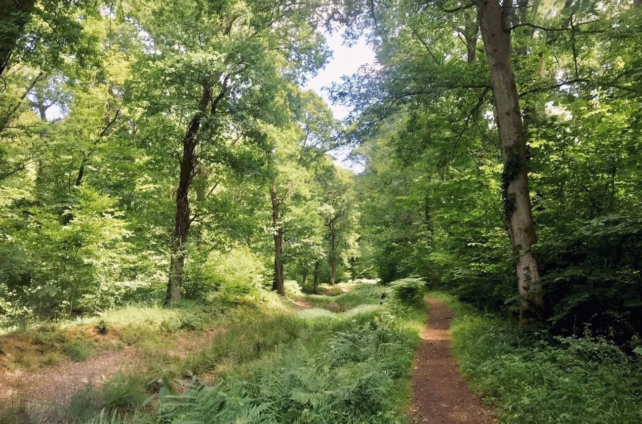
Looking for an adventure or just the chance to get out of the house? Each month we thought we’d share some great walks you can indulge in to spend some time out and about! Sidney Wood & Lost Canal explores mixed woodlands and old parkland as well as a long stretch of the old Wey and Arun Canal, built during the Napoleonic Wars and now reclaimed by nature with some stretches undergoing restoration.
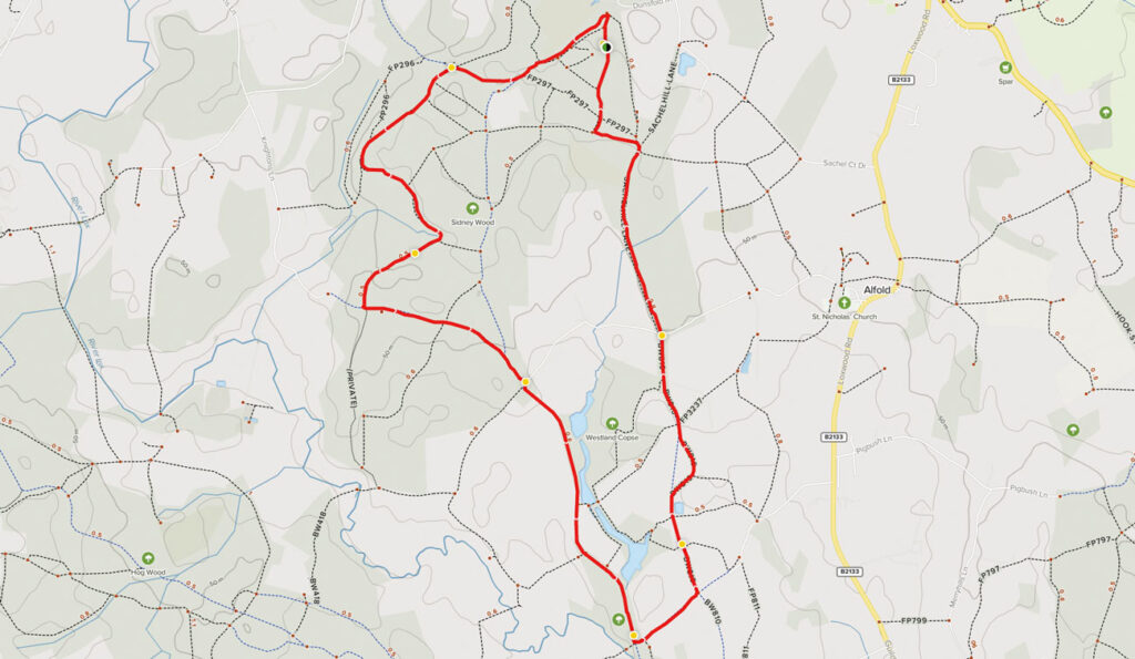
Distance: 7.7 km
Time: Est. 2.5 hours
Route Type: Loop
Elevation Gain: 283 m
Walk Information:
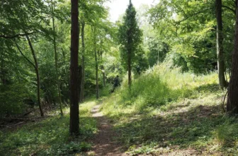
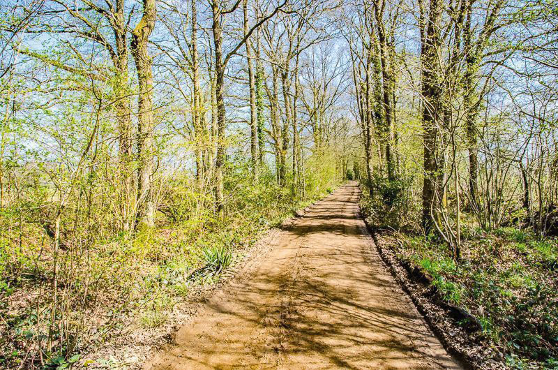
There are no stiles, kissing gates or livestock on route, but you will need to negotiate some gaps alongside vehicle barriers, one bridle gate and some narrow paths and uneven, rutted tracks. The walk is relatively flat, with just a few steady gradients. It follows long stretches of bridleways through woodland and parkland, with some stretches that can become very muddy (so good boots are required, or wellies with grips after periods of rain).
Waypoints
1. From Start to Canal Towpath
Leave the car park via the vehicle entrance and swing left to pass under the height restriction barrier. After 120 metres, turn sharp left onto the first left-hand driveway, soon passing a blue arrow on a waymarker post which marks this driveway as a public bridleway. Continue for about 500 metres to reach a tall fingerpost on your right. Fork right here, leaving the tarmac drive to join the unmade bridleway path, passing between wooden bollards and leading you into the woodland. Follow the bridleway ahead, passing the nature reserve called Fir Tree Copse on your right. Ignore the path signed right into this nature reserve and you will come to a fork in the bridleway. Take the right-hand branch and this leads you to an old metal gate ahead. Pass alongside this gate and you will immediately cross over the course of the derelict Wey and Arun Canal. Immediately after this channel, turn left onto the public footpath, part of the Wey South Path which follows the old towpath.
2. Canal Towpath to Lock Flight
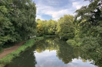
Walk ahead along the old towpath, which we will be following for the next mile. The old canal on your left may appear as a water channel or just a muddy trench, depending on the time of year and recent weather. As you walk along the towpath, you will pass some concrete milestones, which show the mileage to and from The Arun and The Wey. Originally these were installed every half mile so that tolls could be levied accurately. Stay on the towpath, ignoring two footpaths signed off to the right and passing the Arun 13 Wey 10 milestone. The canal now bends steadily left then sharp right. On this next straight stretch of canal you will pass a wider basin area (where an old glassworks once operated) and then a stretch with steeper tree-lined banks. This marks the point which once held a flight of six locks.
3. Lock Flight to High Bridge
Continue along the towpath until you emerge to a junction with a tarmac access track, with the white property called Knightons Court ahead. Turn left to join this tarmac access track leading you through the woodland. You will come to a vehicle barrier ahead, alongside a Sidney Wood sign. Pass alongside the barrier and keep ahead on the stone path leading you through the woodland. At the first woodland crossroads, keep straight ahead. As you reach the next vehicle barrier ahead, pass alongside this and follow the fenced track which leads you past the white property at High Bridge on your right.
4. High Bridge to Gennet’s Bridge Lock
Immediately after the property you will reach a T-junction with a tarmac access lane. Turn right and then immediately left to join the signed public bridleway. This bridleway is still part of the Wey South Path and you will have the canal channel running on your left once again. Follow this pretty stretch of old towpath ahead. Further along, you will be able to see the beautiful fishing lakes of Upper Oakhurst on the far bank to your left. Ignore the three side path options. Just after passing the Arun 11.5 Wey 11.5 milestone, you will find yourself at the restored Gennets Bridge Lock. This lock is one of the latest restoration success stories of the Wey and Arun Canal Trust and had its official opening ceremony in April 2018.
5. Gennets Bridge Lock to Oakhurst Cottage
Immediately after passing the lock, turn left to cross the canal bridge (signed as part of the Sussex Border Path). We have now crossed into the county of West Sussex for this most southerly portion of our walk. After crossing the canal, keep ahead on the bridleway stone track leading you through the woodland. After about 400 metres, you will reach a fingerpost on your left marking a crossroads of bridleway paths. Turn left here to join the unmade (and often muddy) track between hedgerows, signed as a public bridleway. The track leads you past a large cottage on your left, Oakhurst Cottage, to reach a staggered crossroads of tracks.
6. Oakhurst Cottage to Rosemary Lane
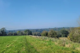
Go straight ahead at this crossroads (actually a small dog-leg left then right) and follow the vehicle track leading you away from the cottage and through the open grassland. Keep ahead on this main track, passing a pretty pond on your right and then bending right then left. You will notice your surroundings have a feeling of historic parkland, and indeed this area is home to a number of old illustrious halls. Just a few hundred metres to the north is Velhurst Farm, a former Wealdon hall house which dates from the early 1500s with 54 acres of formal gardens, ponds and paddocks. At the next fingerpost, ignore the footpaths signed to the side, instead keep ahead on the main bridleway track. Pass through the bridle gate ahead (or the wider farm gate alongside may be open anyway) to reach a fork. Take the right-hand branch, leading you through the trees to reach an access drive lined with wooden posts. Follow the bridleway ahead, with the wooden posts running on your right. You will emerge to a junction with Rosemary Lane.
7. Rosemary Lane to End
Cross over the lane and take the signed public bridleway directly ahead, leading you past the entrance for Rosemary Cottage on your left. Stay ahead on the woodland track bridleway, an old thoroughfare known as Sachelhill Lane. After about 800 metres, look out for a waymarker post on your right, marking a side path on your right. DO NOT take this, instead keep ahead for a further 20 metres and then turn left onto the path into Sidney Wood (marked with a Riding By Permit Only sign). Pass this sign on your right and ignore the small side path into the trees on your right, instead keep straight ahead on the main forest stone path. You will emerge to a junction with a wider stone track (leading ahead and right). Turn right to join the stone track and follow this for about 400 metres to reach a vehicle barrier. Here you will find the car park on your left where the walk began.
See more info on the walk at: www.alltrails.com