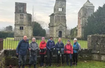
Photos by Users on AllTrails
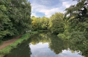
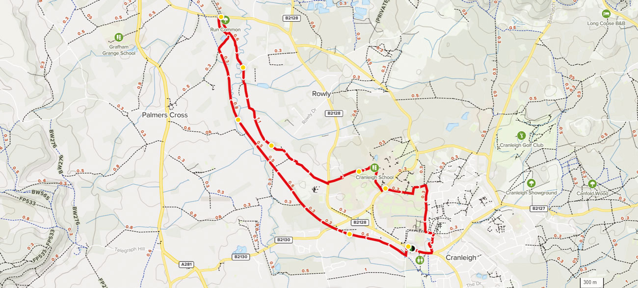
Looking for an adventure or just the chance to get out of the house? Each month we thought we’d share some great walks you can indulge in to spend some time out and about! The Richard Onslow Cranleigh Walk is a 10.0 kilometer loop trail that features a lake and is rated as moderate. The trail is primarily used for hiking, walking, and trail running.
Distance: 10 km
Time: Est. 3 hrs 7 mins
Route Type: Loop
Elevation Gain: 282 m
Walk Information:
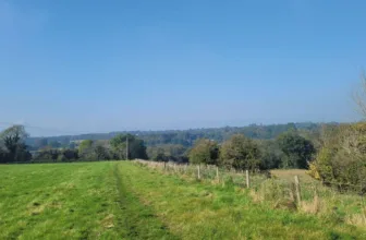
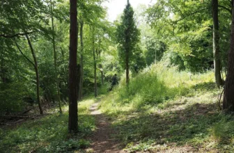
The walk includes only gentle gradients. It follows the surfaced Downs Link on the outward leg, then unsurfaced paths through woodlands and meadows, with some stretches that can become very muddy after periods of rain and in winter. You will need to negotiate several gates, bridges and two stiles (both of which have adjacent dog gaps). There is no livestock on route, but there is a chance you may come across horses in one of the fields. There are a couple of road crossings that need care.
Waypoints
1. Start to Railway Cottages
Standing on the pavement with your back to The Richard Onslow, walk ahead for a few paces to reach the bus stop and pub sign. Cross over the High Street with care to take Knowle Lane opposite. Follow Knowle Lane to pass the pay-and-display car park on your right, then just 5 paces later, turn right through a metal-gate-side gap to reach a junction with a surfaced path- the Downs Link. Turn right to join this. The Downs Link is a 36-mile footpath and bridleway, running between St Martha’s Hill in Surrey and Steyning in West Sussex. It follows the line of two former railways, the Cranleigh Line and the Steyning Line, both of which were closed during the Beeching Cuts in the 1960s. Follow the Downs Link path ahead, passing along the outskirts of Cranleigh and then crossing the entrance drive for the former Railway Cottages on your left.
2. Railway Cottages to River Crossing
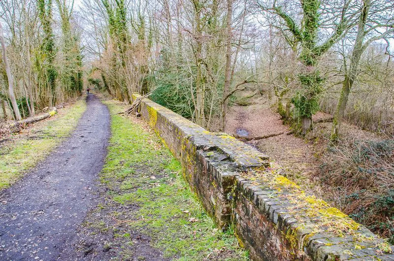
Continue along the Downs Link, going straight ahead at a crossroads with a footpath and then passing under a tall arched bridge which carries the B2130 overhead. Stay with the Downs Link which now leads you through sections of woodland and open countryside. Ignore any side footpaths and, after about 1800 metres, you will cross the River Wey (on a bridge with brick walls each side).
3. River Crossing to Wey South Path
Continue on the Downs Link, with the River Wey now meandering across to your right. Further along, you will cross a staggered bridge, with a beautiful old brick wall first on your left and, 40 metres later, a similar wall on your right. This marks the point where an impressive iron-truss bridge once carried the railway over the old Wey and Arun Canal. Stay with the Downs Link and, about 300 metres after the canal crossing, you will come to a waymarker post on your left, marking a footpath crossroads. Turn right here to join the signed footpath, passing between old concrete gateposts. Follow the path with woodland on your left and an open field on your right. The path leads you past a beautiful woodland lake on your left and continues through a pretty stretch of coppiced woodland. At the end of the lake, you will see a waymarker post ahead. Turn left here and follow the path through the trees and then continuing along the right-hand edge of an open grass clearing. At the far side of the clearing you will emerge onto Run Common Road. Turn right for 15 paces and then turn right again to join the public footpath, part of the Wey South Path.
4. Wey South Path to Farm Track
Follow this woodland path ahead, with the old canal running on your right. Beyond the woodland, your canal-side path continues with fenced fields on your left. As you reach a fingerpost ahead, turn left to cross the stile to enter a rough grass paddock. With your back to the stile, turn immediately right to follow the obvious, worn grass path. The path cuts diagonally across the field and then runs immediately alongside the fenced River Wey. You will see the farmhouse of East Whipley Farm on the far side of the river. The path swings steadily left and then leads you over a wide footbridge across the River Wey. At the far side, turn right and then, just after the wide metal gate on your left, cross the stile alongside this gate. You will emerge to a T-junction with a concrete farm track, marked as a public bridleway.
5. Farm Track to Rowly Farm
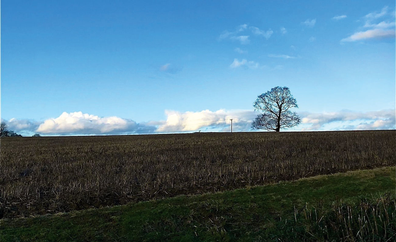
Turn right to join the farm track. A little way along, the track leads you over a bridge with tall wooden sides to reach a track fork. Take the left-hand branch, which heads into the corner of an open grass field and then ends. Continue on the grass track, which leads you across the centre of the grass field. At the far side of this first field, the grass track leads you across a small stream within a small copse and then continues along the left-hand edge of a second grass field. When the trees on your left end, simply keep ahead on the grass bridleway through the centre of open grassland. This habitat is perfect for ground nesting birds so keep to the path and listen out for the beautiful sound of skylarks in the spring months. There are beautiful views of the North Downs across to your left. At the far side of the grassland, continue ahead on the public bridleway, with the buildings of Rowly Farm immediately on your left and a hedgerow running on your right.
6. Rowly Farm to All Weather Pitches
Beyond the farm buildings, the path leads you through a tunnel of trees, emerging out to a T-junction with a vehicle track. Turn right to continue on the signed public bridleway which leads to a whitewashed brick and tile-hung cottage on your left. You will see a junction of paths at this point. Ignore the stile on your right, instead keep straight ahead on the enclosed bridleway path. As you reach Norther Farm, dog-leg right and then left to join the tarmac driveway. Follow this driveway for about 500 metres to reach a junction with Guildford Road. Cross over to the far pavement with care, turn left for about 20 metres and then turn right through the gate-side gap to join the signed public footpath. Walk directly ahead along the left-hand edge of the grass field and, at the far side, continue ahead on the enclosed grass path. You will have the fenced sports fields of Cranleigh School on your right and ahead you will be able to see the school buildings. Stay with the enclosed grass path and, eventually, it swings right to reach a grass clearing with benches overlooking the all-weather pitches.
7. All Weather Pitches to Horseshoe Lane Crossing
Turn left to follow the path with the all-weather pitches on your right. Beyond the pitches, keep ahead on the concrete driveway to reach a T-junction with a school access road. Turn right and follow the access road through the school buildings and a parking area. At the next T-junction, turn right again. This roadway passes the corner of the all-weather pitches on your right before swinging steadily left, with the cricket pitch and pavilion across to your right and more school buildings on your left. You will emerge through the school gates to reach a junction with Horseshoe Lane. Turn left to reach the pedestrian crossing and then use this to cross over Horseshoe Lane.
8. Horseshoe Lane Crossing to End
After crossing the road, turn left and then right to join the signed public footpath. Follow the stone footpath between garden boundaries, and then leading you between more of the fenced school grounds. Keep ahead on the obvious enclosed footpath, crossing a small sleeper bridge then turning left and later turning right. You will now have a large fenced school playing field on your right. Just before you reach the end of this playing field, you will see a stile on your right and a waymarker post on your left. Ignore this, instead keep ahead for 20 metres to reach the field corner and turn right to continue with the fenced field on your right. At the far end, keep ahead past an old concrete stile and continue with a stream and garden properties to your left. You will eventually emerge out to a junction with a residential road. Cross to the far pavement and turn left along this. Where the road bends away to the left, simply keep ahead on the tarmac footpath, soon reaching a footpath crossroads. Turn right and this path leads you directly to the Church of St Nicholas in Cranleigh. Fork right through the wall gap to join the tarmac path entering the churchyard. At the path junction, turn right to pass through the churchyard with the church immediately on your left. After passing the front door of the church, simply keep ahead on the tarmac path and leave the churchyard via the large stone lychgate. Turn right for a few paces to reach the main village road and turn right to join the pavement. After just 300 metres, you will come to The Richard Onslow on your right for some well-earned hospitality.
See more info on the walk at: www.alltrails.com